How to use the PA NWI Land Analysis Mapping Application
This Tutorial describes how to use the PA NWI Land Analysis Mapping Application, from the function of each tool to common procedures.
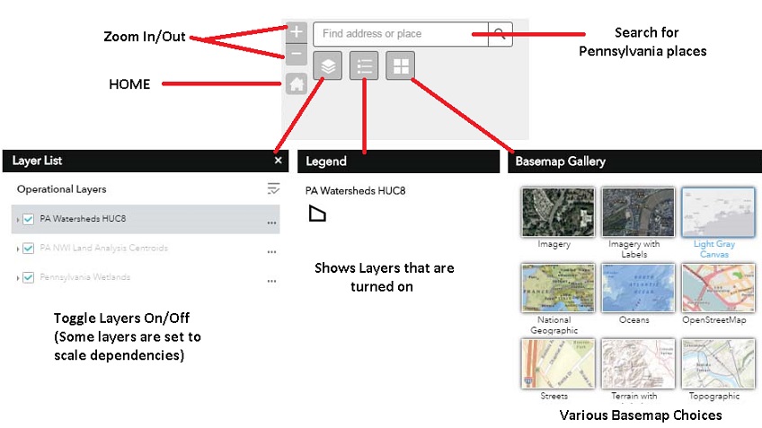
.....Basic Tools.....
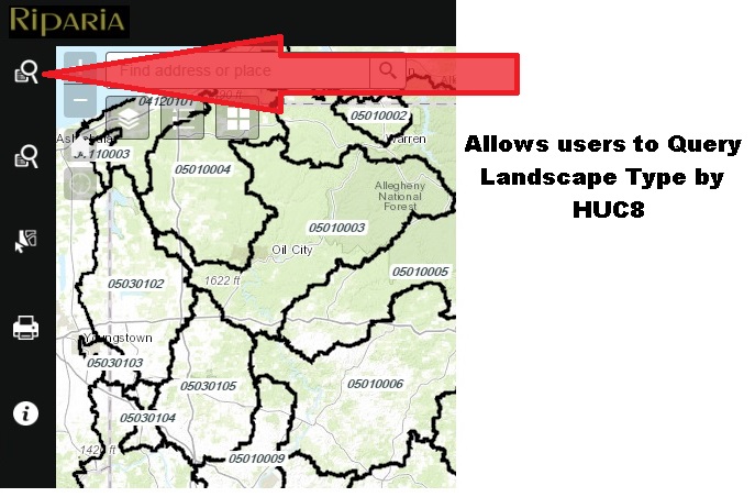
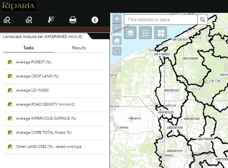
.....Landscape Analysis per WATERSHED (HUC8).....
Allows the user to Query Landscape Type by HUC 8
From Tasks Tab choose a Landscape type to Query. This query will return the Average Percent Landscape Type of your choice across all HUC8s in Pennsylvania.
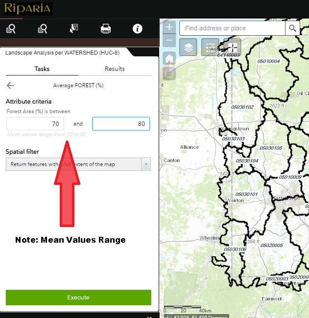
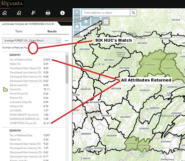
Enter the Attribute Criteria Values for the Average Landscape Percentage you wish to search for. In this case, we will search for HUC8's with Average Percent Forested Land between 70 - 80%.
NOTE: THE MEAN VALUES RANGE..... VALUES WILL BE WITH IN THESE PARAMETERS
Click Execute to perform your query
Six HUC8's matched the query and are highlighted. All attributes are displayed in the query results
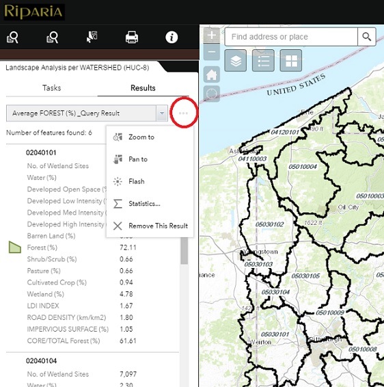
Use the Ellipsis in the Results tab to Zoom to, Pan to, Flash, or Sum Statistics of your query. This is also how you Remove the Results of the query to start over.
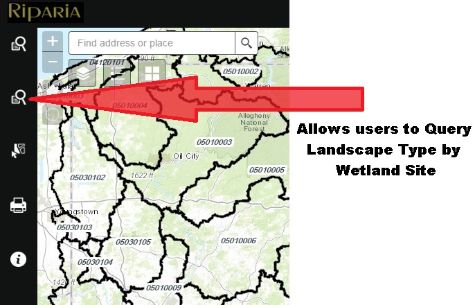
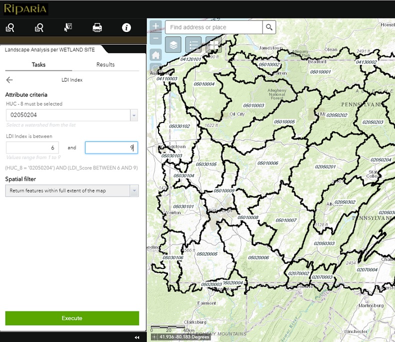
.....Landscape Analysis per WETLAND SITE.....
Allows the user to Query Landscape Type by Wetland Site
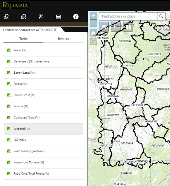
From Tasks Tab choose a Landscape type to Query. This query will return All Wetland Sites that match your landscape query within the HUC8 of your choice.
 >
>
Select from the Drop Down the HUC you are interested in Querying. Enter the Attribute Criteria Values in the range you wish to search for. In this case, we will search for Wetland sites with a LDI Index between 6 and 9 in HUC 02050204.
NOTE: VALUES RANGE..... VALUES WILL BE WITH IN THESE PARAMETERS
Click Execute to perform your query
 >
>
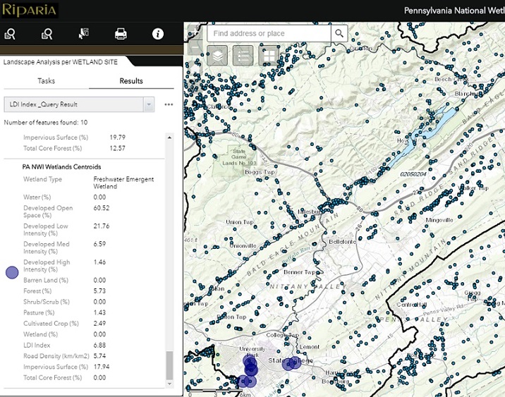
Ten Wetland Sites matched the query and are highlighted (blue circles). All land cover attributes (%) are displayed in the query results.
 >
> .....Landscape Analysis per Area of Interest.....
Allows the user to Query Landscape Type by Area of Interest
Select an Area of Concern (Zoom into Area of Concern)
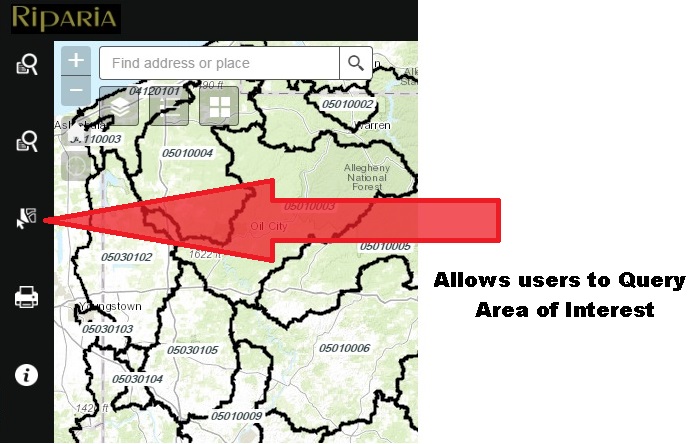
Use Navigation buttons to zoom to Area of Interest
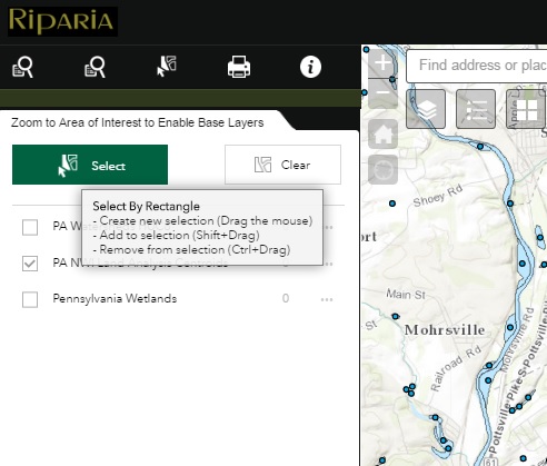
In the Table of Contents, make the layer(s) active you want to select
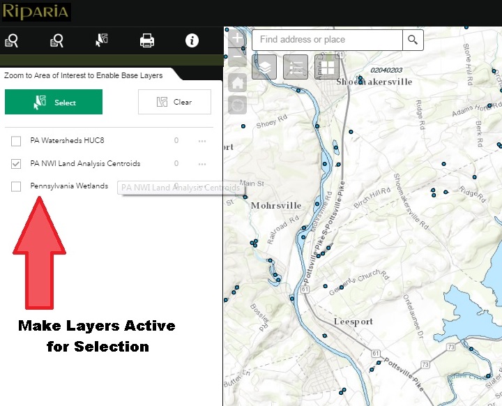
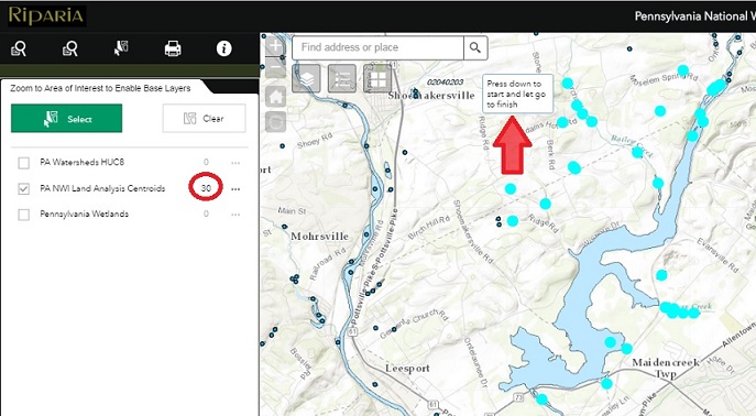
Press Select Button... Follow instructions to Create a new selection by Dragging the mouse to Select by Rectangle.
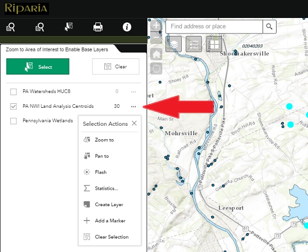
Select Area of Interest... Press down to Start and Let Go to Finish. In this example 30 PA NWI Land Analysis Centroids were selected.
Use the Ellipsis next to the Selected Features for further Section Actions
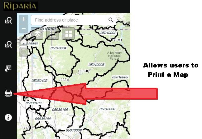
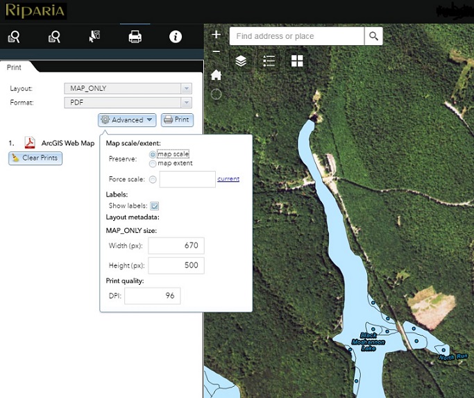
.....Print Button.....
Allows the user to Print a Map with multiple Layouts and Formats.
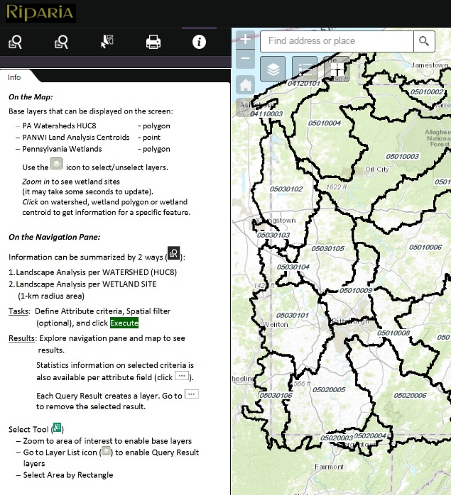
.....Information.....
Contains Application Information
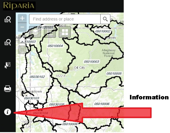
Quick reference Information on the map, map layers, and the navigation pane.
 >
>